Phase I of Ridden TREC Competition / Points: 240
This phase is also known as the POR (from Parcours d’Orientation et de Régularité).
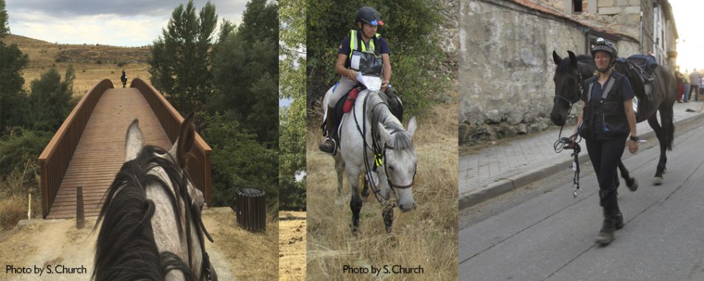
The POR phase of a TREC competition is designed to demonstrate skills need to navigate a mapped route in a time accurate manner. Riders are judged based on accuracy of both speed and direction. Tools permitted include watch, compass, and map. No GPS allowed!
THE MAP:
TREC makes use of Topographic Maps with a scaled grid overlay. The map scale may vary depending on riding area. In international competition the scale is typically 1:25,000 K.
Competition maps include the starting point, the route, and directional arrows. Checkpoints are not indicated on the map (see below).
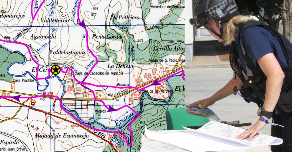
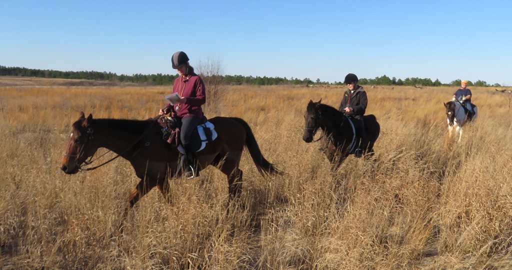
Right: Rider making notes on her competition map before departing.
© Kim Stoddard
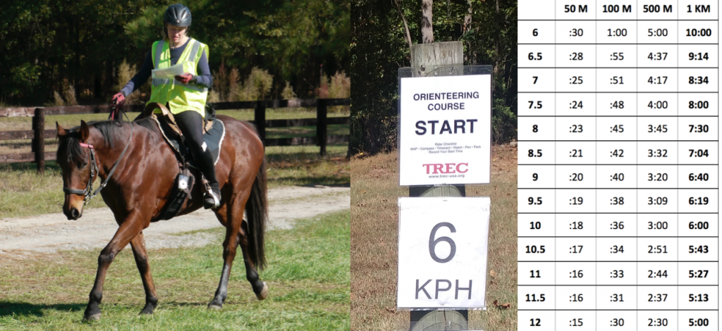
SPEEDS:
Speeds are posted at the start, and at each stage checkpoint along the route. The goal is to travel at the posted speed until arriving at the next checkpoint. Factors that affect time include terrain, stopping to orient oneself, and getting lost. Speeds are posted in KPH.
© Kim Stoddard
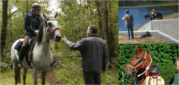
CHECKPOINTS:
Riders come to unmarked checkpoints along the route where their direction and or times are recorded by the course judges.
Types of checkpoints:
- Stage Checkpoints: Riders are stopped and asked to present timecards. Checkpoint judges record time in and set time out (usually a 5 minute interval). Riders are encouraged to make use of this time to get their bearings, water horses, take a break. If a horse appears in distress a check point judge may hold the rider for a longer period.
- Route Checkpoints: (also called control points or pass through checkpoints): These types of checkpoints indicate whether a rider is on the right course (or not). These may be manned or unmanned checkpoints, In the latter case riders may be instructed to sign their name to a poster or punch their timecards with a punch provided.
- Veterinary Checkpoints: In more challenging competitions, their may be vet checks on route to determine a horse’s ability to continue. At the end of an international level course, riders have 30 minutes to report to the vet check after completing the route. in this case, vets determine whether they are fit to continue on to the next phase.
SCORING:
Each rider starts with 240 points from which penalty points are subtracted based on performance. Common types of penalties are listed below.
- Time penalties: There is an optimum time set for each section of the course based on distance and speed. Riders receive 1 time penalty point per every (4) seconds over or under the optimum time for each section.
- Navigational Penalties: Entering a Checkpoint from the wrong direction (-30), Missing a Checkpoint (-50), Missing a Control / Pass Through Check Point (-X)
- Additional Navigational Tests: At higher levels, sections of the route may require navigation based on azimuths or grid coordinates. Scoring is based on the accuracy of the execution.
- Equipment Penalties: -1 point per missing item. See below.
Timecards:
Riders carry timecards with them that are marked by the course judges. This is the official record of your ride – do not lose it!
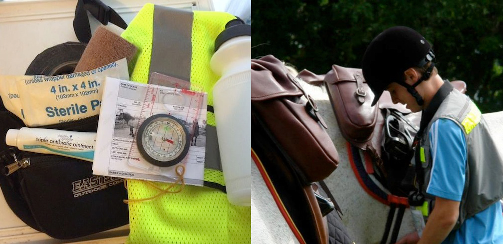
Equipment:
In the orienteering phase riders are required to carry specific safety equipment. Equipment may be checked at any time while on course.
Required Items include:
- Rider and Horse Identification
- Halter and Lead Rope
- High Visibility Reflective Gear / Safety Lights
- Hoof Boot or Farrier Kit (for shod horses)
- First Aid Kit for Horse & Rider
Recommended items include:
- Food and Water for Horse and Rider
- Whistle
- Flash Light / Headlamp
- Weather Appropriate Clothing
- Watch / Compass / Pens
Levels: USA 2108
| LEVEL | I | II | III | IV |
| Distances | Up to 12 km | Up to 20 km | Up to 35 km | Up to 45 km |
| Map Skills | Map should be able to be ridden mostly from clear landmarks. | Map to include some challenges in reading the trail, landmarks and contour lines. Use of compass may be needed. | Use of compass to be necessary and an ability to read the terrain are key skills at this level. | Use of compass to be necessary. Azimuths and grid reference points may be part of the test. |
| Speed &Timing 6-12 km/h | Slower speeds, aimed toward rider and horse safety, fitness and control. | Speeds moderate. Timing and judging pace becomes more challenging. | Speeds varied. Speed and time become factors in identifying correct trails. | Speeds varied. Emphasis on speed and time calculations as critical tools. |
In addition:
Level I-II Riders may ride in groups of up to 4 people. Riders may be given a map with the route already drawn in and have a chance to study the route before they start.
Level III – IV Riders report to a map room where they are given a set period of time to transcribe the route onto a blank base map. Accurately transcribing the route takes practice! At these levels, riders go out alone.
No crying in the woods!
The POR Phase of a TREC Competition is often regarded as the most challenging as it requires both map skills and timing. Learning these skills is a lot of fun and helps riders develop practical knowledge and the confidence to explore new territories with their horse!